
How It Works
-
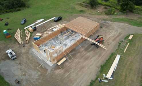 Aerial Imaging – We begin by capturing high-resolution aerial images of your property using drones. This real-time imagery gives us a detailed view of topography, tree coverage, elevation changes, and other physical features.
 -
3D Modeling – Next, we overlay your building plans, driveway layouts, utility paths, water well locations, and septic system designs into a 3D model that sits right on top of the live aerial footage. This creates a precise visual roadmap that shows exactly how everything will fit together on your land.
-
Planning & Coordination with Interactive Maps – With a clear view of the land and planned structures, we can coordinate everything from where to clear trees and carve in
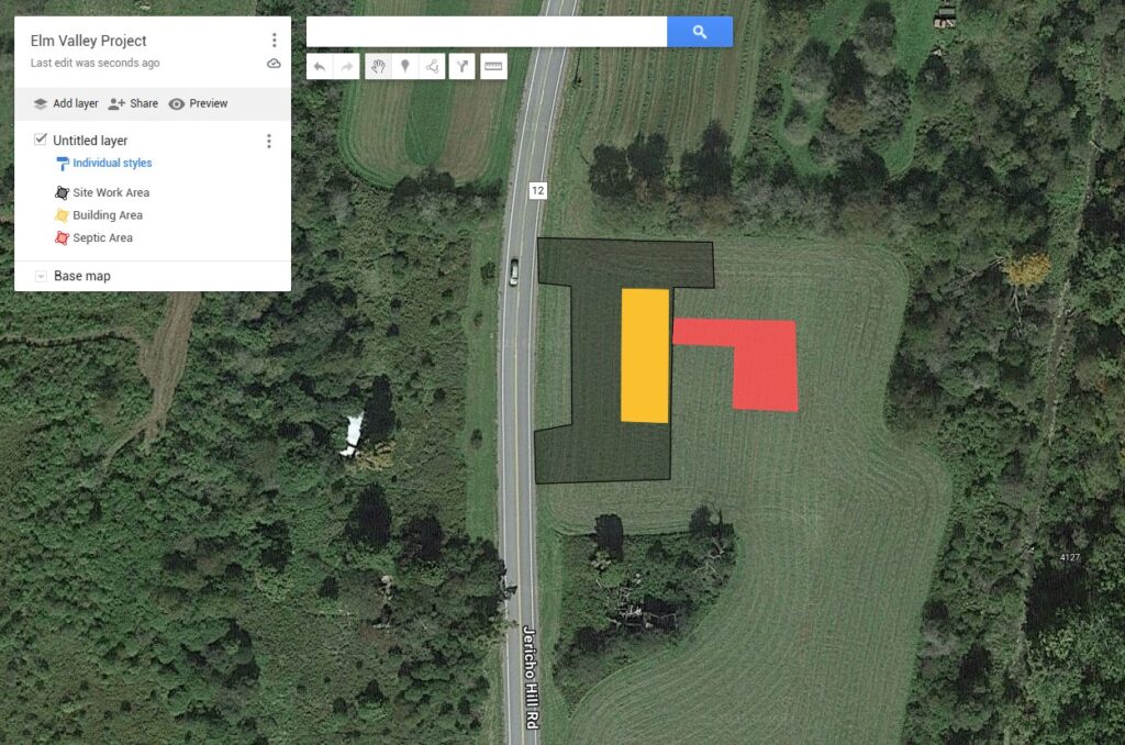 driveways, to the optimal placement of your water well and septic system—installed by LandWorks Services according to Health Department requirements. This approach ensures your septic system is placed and built to code, while also assisting with permitting and alignment with local regulations and zoning laws.
The Benefits
-
Clarity: Understand your project layout in the context of your actual land.
-
Efficiency: Eliminate guesswork and reduce planning time.
-
Accuracy: Improve placement precision for utilities, driveways, and structures.
-
Cost Savings: Avoid unexpected obstacles and changes that drive up expenses.
-
Transparency: Keep everyone on the same page, from the builder to the excavator.
Who This Helps
Whether you’re working with Amish craftsmen to build a barndominium, installing a septic system per Health Department regulations, or drilling a well with our partners at Root Well Services, this approach ensures everything is perfectly aligned. It’s particularly helpful for first-time homebuilders, general contractors, and anyone needing a streamlined process with no surprises.
Start Smarter
With LandWorks Services, you don’t just get a land management partner—you get a strategic planning team that brings clarity and control to your vision. Ready to see your project come to life before it begins? Let’s start planning smarter together.